 |
am3zzn00000636
NAVIGATION FUNCTION
id092000101300
Outline
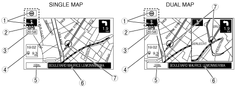
Map Screen Selection
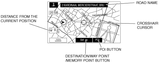
Current position map
am3zzn00000636
|
|
No. |
Contents |
Description |
|---|---|---|
|
1
|
Map orientation
|
North up
• Geographic north is up.
Head up
• The direction you are heading is up.
|
|
2
|
GPS reception indicator
|
Illuminates when receiving signals from 3 or more satellites.
|
|
3
|
Clock
|
Clock will be displayed when you set up clock on navigation set up on.
|
|
4
|
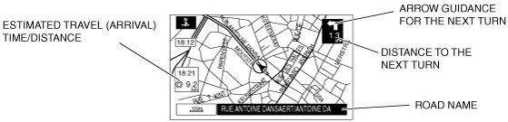
Travel time and distance
|
Shows the estimated travel (arrival) time and distance
|
|
5
|
Map scale
|
The map can be displayed in 13 steps with scale from 50 m to 256 km {1/32 mile to 128 mile}
|
|
6
|
Road name
|
Shows the name of the road you are currently driving on.
|
|
7
|
Vehicle position
|
Shows the current position and direction of the vehicle.
|
Scroll map mode
am3zzn00000637
|
Guide mode
am3zzn00000638
|
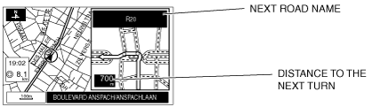
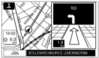
Enlarged Junction Diagram
am3zzn00000639
|
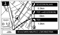
Turn list
am3zzn00000640
|
Turn arrow
am3zzn00000641
|
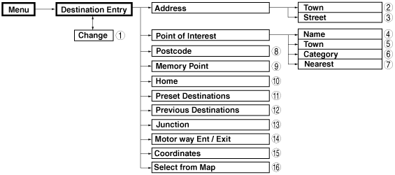
Destination Setting Function
Outline
am3zzn00000533
|
|
No. |
Contents |
|---|---|
|
1
|
Change area set from the current setting.
|
|
2
|
Sets destination by inputting town name or selecting town name.
|
|
3
|
Sets destination by inputting street name and selecting street name.
|
|
4
|
Sets destination by selecting POI name and selecting POI.
|
|
5
|
Sets destination by selecting POI town, inputting town name and selecting POI.
|
|
6
|
Sets destination by selecting POI category, inputting target name and selecting POI.
|
|
7
|
Sets destination by inputting POI nearest facility.
|
|
8
|
Sets destination by inputting postcode.
|
|
9
|
Sets destination from a list of points stored by the user.
|
|
10
|
Sets destination to home.
|
|
11
|
Sets destination to preset destination point.
|
|
12
|
Sets destination from a list of recent destinations.
|
|
13
|
Sets destination by inputting/selecting the street name.
|
|
14
|
Sets destination by inputting/selecting the name of the motor way.
|
|
15
|
Sets destination by inputting coordinates.
|
|
16
|
Sets destination by moving the crosshair cursor to the destination when in scroll map mode.
|